
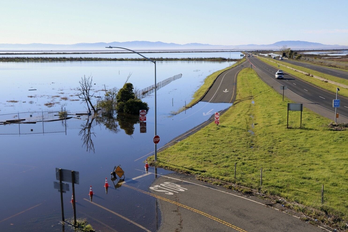
Bay Area officials are taking steps to prepare, but this winter's super-strength El Niño could end up being a major inconvenience or worse, flooding major roadways and potentially impacting San Francisco International Airport.
Emergency work is already underway to raise flood-prone portions of Highway 37 in the North Bay, but that is not the only major roadway or piece of infrastructure that could see significant impacts from flooding caused by heavy rain and high tides this winter. SF Mayor Daniel Lurie last week declared an official state of emergency for the city ahead of the winter season, which frees city departments to forgo certain contracting requirements and speed the purchasing of things like flood barriers, pumps, generators, and other supplies to address potential flooding.
Just this past weekend and into Tuesday we saw a preview of things to come, with some especially high tides inundating parts of southern Marin County and Palo Alto as well as the Embarcadero.
But once the rain starts in earnest, these impacts will likely seem minor. A new report from the UC Davis Road Ecology Center, picked up by SFGate, suggests that the water in the Bay could rise by several feet under various conditions this winter, which could directly impact low-lying areas including the Bay Bridge toll plaza, SFO, Oakland Airport, Treasure Island, and shorelines all around the Bay and San Pablo Bay.
"The combination of Kelvin waves, king tides, heavy precipitation, and the repeated storms pushing water into the Bay could add up to 3 feet of the shore fairly easily,” says Fraser Shilling, the report’s author and the director of the UC Davis Road Ecology Center, speaking to SFGate.
The report further suggests that recent flooding in Southern California, caused by storm surges from hurricanes Rachel and Polo, could be a precursor of what we will see up and down the California coast this winter.
"We face the risk — though not the certainty — of catastrophic flooding in a variety of coastal towns this winter," Shilling said in a statement. "It’s important to be informed of risk so you can make decisions."
A UC Berkeley study in 2022 found that almost 70% of the runways at SFO and 100% of the runways at Oakland Airport are at risk of flooding due to sea-level rise alone in the next several decades. The lead author of the study, researcher Sarah Lindbergh, told the Chronicle at the time that while catastrophic flooding at SFO or Oakland Airport wasn't likely in the next two decades, it couldn't be ruled out if a so-called 100-year storm were to occur.
Also facing flood risks this winter are coastal towns around Monterey Bay and Santa Cruz, the report suggests.
In San Francisco, the season could bring major erosion to Ocean Beach — which may spend days totally underwater — and flooding to Marina Green and elsewhere.
"I think we’re going to see tides that are high enough to shut the entire Embarcadero down, and the Embarcadero is kind of a flood conduit for larger areas [near the waterfront] to flood," says Kris May, a coastal engineer who leads Pathways Climate Institute, speaking to the Chronicle this week.
The Port of San Francisco is reportedly preparing for a number potential catastrophes, including the flooding of the Muni Metro tunnel entrance on the Embarcadero near Pier 14, which could then lead to water pouring into Embarcadero Station.
Port officials also tell the Chronicle that they're worried about flooding in Islais Creek, which can occur with high tides, and that can subsequently lead to the flooding of Pier 80 — where the Portola Music Festival is held, and which is home to a major cargo terminal — and Pier 96, which is home to a major Recology facility.
Mission District residents and businesses are also worried they will see a repeat of the flooding that happened on New Year's Eve 2022, which turned Folsom Street around 15th Street into a river, and triggered a mudslide on Bernal Hill.
And not to be too alarmist, but studies in recent years have predicted that California could see one of the worst natural disasters in history if we were to be hit with a 30-day-long rainy weather pattern, the likes of which caused the Great Flood of 1862, which flooded the entire Central Valley, destroyed farms, turned Sacramento into a city of canals, and caused countless livestock deaths in addition to human deaths.
That flood was triggered by a parade of storms that began in December 1861 and continued into January 1862 without a break.
Get some sandbags and hunker down, and let's hope it all turns out not so bad, or catastrophic.
Previously: El Niño Emergency Project Will Shut Down Part of Highway 37 Next Week


